
In today’s construction and infrastructure, drones have upgraded from being cool gadgets to practical tools. While traditional surveyors bring expertise to the table, there are times when they’re held back by tricky terrain, dangerous environments, or time limits. That’s where drones have stepped in, not to replace people, but to fill in where humans can’t always go.
1. Post-Disaster Terrain Mapping in Nepal
After Nepal’s 2015 earthquake, many roads were destroyed and whole regions became hard to reach. Surveyors simply couldn’t access several of the affected zones. The only option remaining was drones, flying over to take clear, detailed images and build maps that helped emergency teams to plan rescue operations. In just a few days, they gathered information that would have taken weeks with manual surveying.
2. Surveying Volcanic Eruption Zones in Hawaii
When Hawaii’s Kilauea volcano erupted in 2018, lava tore through communities and made the area extremely dangerous. Surveyors couldn’t safely work near the hot ground and toxic air. Instead, drones fitted with heat-sensitive cameras flew above the lava flows, helping scientists track its movement. The data also helped authorities plan safe evacuation routes and update local risk maps.
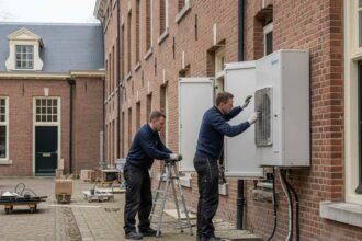
3. Reclaiming Land in the Netherlands
In the Netherlands, where the land is below sea level, the new land is constantly being built and reshaped. During the Marker Wadden project in 2022, drones were used to monitor newly formed islands. The area was changing rapidly, and human teams struggled to keep up. At that moment, drones deliver up-to-date images and measurements, helping engineers adjust their work in real time and reduce environmental side effects.
4. Monitoring Dangerous Mining Sites in Australia
Australia’s mining operations often happen in rough and risky locations. In several open-pit mines, surveyors faced loose rocks and steep walls. To avoid accidents, companies started using drones to fly over the mining sites. The drones captured images and measured stockpile volumes without anyone needing to step into dangerous zones, saving time and improving safety.
5. Inspecting Remote Rail Networks in Canada
Canada’s railways stretch across vast forests, mountains, and rivers. Checking these routes is a huge task, especially in remote areas. Canadian Pacific Railway began using drones to look over long stretches of track. What used to take days, sometimes involving helicopters or special vehicles, could now be done faster, cheaper, and without disrupting rail services.
6. Preserving Ancient Ruins in Peru
In Peru’s Sacred Valley, many ancient ruins are found on steep hills and rough terrain. Walking into these sites risks damaging them. Instead, drones with special sensors flew over the ruins and created 3D digital maps. These detailed records are now being used by historians and conservationists worldwide, helping preserve the site without ever stepping on it.
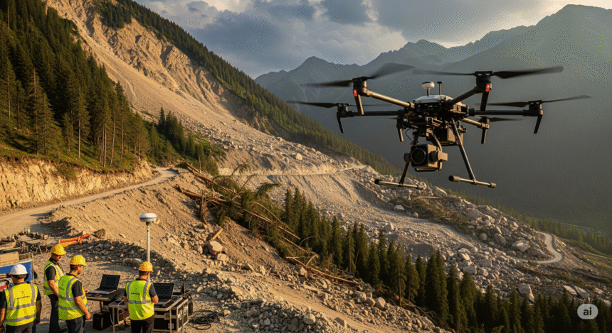
7. Mapping Dense Forests in the Amazon
Thick trees and wild terrain make the Amazon rainforest nearly impossible to survey on foot. In 2023, scientists used drones with LiDAR systems to look below the trees and study the land underneath. This helped track changes in the forest and spot illegal logging. Without drones, gathering this data would have taken years, and possibly harmed the environment in the process.
8. Tracking Coastal Erosion in the UK
In parts of the UK, crumbling cliffs and shrinking beaches are a growing problem. Surveyors found it too risky to get close to unstable edges. Drones became a safer choice. They flew along the coast in places like Norfolk and East Sussex, collecting images to help experts measure how quickly the land was disappearing. The data supports decisions about where to build sea defenses or move roads.
9. Supporting Smart City Projects in Dubai
Dubai is building more than just skyscrapers; it’s working toward becoming a tech-driven city. As construction speeds up, traditional survey teams struggle to keep pace. Drones were used to scan roads, building sites, and utility lines quickly. Their footage was fed into the city’s planning software, helping designers and engineers make quicker decisions and avoid mistakes on-site.
The Sky’s the Limit
Drones aren’t here to take over surveying; they’re tools that help surveyors do more. These examples show how drones have stepped in when humans couldn’t, whether due to danger, time pressure, or physical limits. They’re offering new ways to get clear, helpful information from places that were once out of reach. As drone tech gets better and easier to use, more industries will likely turn to them for jobs that are too difficult, or just too slow, by hand.